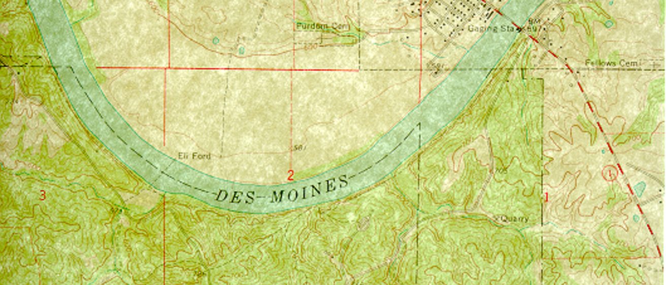
Topographic map view: Sharp contrasts in terrain at Lacey-Keosauqua State Park appear on the Keosauqua Quadrangle (U.S. Geological Survey, 1968). The level land inside the river’s bend is underlain by sandy river deposits. The outside of the bend is cutting into much older glacial and bedrock deposits, and the result is rougher terrain.
Explore the categories below to access IGS research and information.
Interactive Maps
The IGS has developed a series of interactive maps that provides a fun and informative way to access the survey’s vast catalog of publications and information.
Publications
The IGS Geode
The IGS Geode is our annual publication highlighting current IGS research projects, publications, and finances. You can check out the latest issue as well as back issues.
Publication Database
The Iowa Geological Survey maintains a catalog of publications providing information on the geological resources of Iowa, including groundwater, bedrock, glacial materials, and mineral resources. Out-of-print/loan publications are no longer available for purchase. Loan copies for most of the publications may be obtained on request from the IGS for a 30-day period. Out-of-print publications may also be accessed at some university and public libraries.
Databases
GeoSam
GeoSam is Iowa’s geologic site and sample tracking program. GeoSam provides location, identification, and other key information about every available well, rock exposure, or site of geologic information in Iowa. For more information, an FAQ document is available.
GeoCore
IGS GeoCore tracks cores in the IGS’ Rock Library. GeoCore stores depth intervals, storage location, and high-resolution photographs for each core stored.
Pump Test
IGS Pump Test gives users electronic access to IGS’ collection of aquifer pumping test data and results. This information can be used to evaluate long term well yields, and to construct and calibrate groundwater flow models.
GeoLab
GeoLab showcases laboratory results from over 6,000 samples across Iowa. Users can filter results using text-based search options or an interactive map.
Results found in GeoLab include: grain size, radiocarbon dates, clay mineralogy, pXRF, soil carbon and nitrogen, matrix carbonate, bulk density, and clast lithology data.
Relevant External Links
Iowa GeoData
Iowa GeoData includes many IGS ArcGIS shapefiles.
National Ground-Water Monitoring Network
The National Ground-Water Monitoring Network includes groundwater quality and water-level data from selected sites in Iowa.