The geophysical capabilities and expertise of IGS researchers can be a valuable addition to a wide variety of research projects involving Iowa’s subsurface.
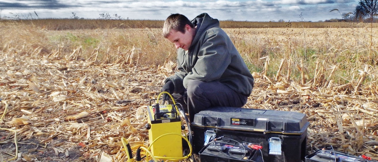
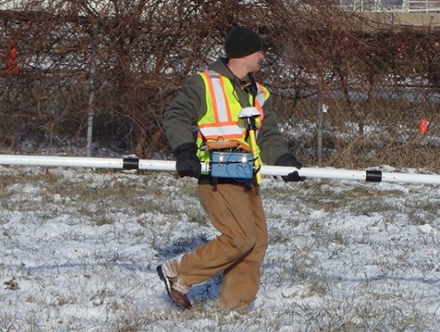
The IGS has an array of geophysical capabilities that can be utilized to better visualize, understand, and characterize Iowa’s subsurface. Geophysical methods employed by IGS researches includes electrical resistivity (ER), electromagnetic terrain conductivity (EM), seismic refraction, passive seismic imaging, and seismic monitoring. These methods have a variety of research applications ranging contributing to the many disciplines, including geology, hydrogeology, and geotechnical engineering. IGS researchers have used geophysics to identify extents and thicknesses of alluvial aquifers, develop relationships between geophysical and hydrogeologic parameters, find historic locations of meandering rivers, locate underground sinkholes and historic cellars, determine the depth to bedrock, identify voids and fractures in bedrock, and characterize different subsurface soil characteristics within local field sites.
Projects
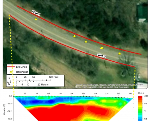
Cedar Rapids Beer Caves
Sponsor: Iowa Department of Transportation
Background: In the summer of 2014, heavy rains opened a sinkhole near the Seventh Street off-ramp in downtown Cedar Rapids. Iowa Department of Transportation bridge inspectors noted that the sinkhole seemed to open into some sort of underground cavern.
Goal: The IGS use geophysics to help identify and map the extent of the caves.
IGS Strategies: The IGS contracted with the Iowa DOT to use advanced geophysical technology to help detect and delineate the structures without needing to venture below ground level.
Aquifer Exploration for Harlan, Iowa
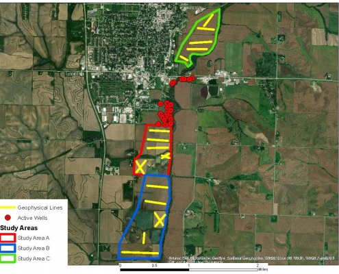
Sponsor: City of Harlan, Iowa
Background: The City of Harlan contacted the IGS for help in determining where to site a future wellfield. The IGS used electrical resistivity geophysics to scan the subsurface for areas with better water production potential.
Goal: Identify new wellfield areas
IGS Strategies: Electrical resistivity, pump tests, groundwater modeling
Durango Geophysical Investigation
Sponsor: Iowa Department of Transportation
Background: The IGS recently investigated potential mining hazards with geophysics and drilling for an upcoming US 52 reconstruction effort.
Goal: The IGS used geophysics to help identify subsurface hazards under U.S. Highway 52.
IGS Strategies: Geophysical surveys and drilling were used to determine the integrity of the roadway.
Services
The geophysical capabilities and expertise of IGS researchers can be a valuable addition to a wide variety of research projects involving Iowa’s subsurface.
The IGS has an array of geophysical capabilities that can be utilized to better visualize, understand, and characterize Iowa’s subsurface. Geophysical methods employed by IGS researches includes electrical resistivity (ER), electromagnetic terrain conductivity (EM), seismic refraction, passive seismic imaging, and seismic monitoring. These methods have a variety of research applications ranging contributing to the many disciplines, including geology, hydrogeology, and geotechnical engineering. IGS researchers have used geophysics to identify extents and thicknesses of alluvial aquifers, develop relationships between geophysical and hydrogeologic parameters, find historic locations of meandering rivers, locate underground sinkholes and historic cellars, determine the depth to bedrock, identify voids and fractures in bedrock, and characterize different subsurface soil characteristics within local field sites.
Aquifer exploration and characterization
- Geophysics
- Groundwater Modeling
- Groundwater Monitoring
- Drilling
- Geologic Assessments
Geologic hazard characterization
- Geophysics
- Drilling
- Geologic Assessments
Contact Us

Jason Vogelgesang
Hydrogeologist
Geophysics, Geological Data Preservation
104 OIGS
jason-vogelgesang@uiowa.edu
319-335-4231