Explore the IGS Interactive Map Series on Iowa Landforms
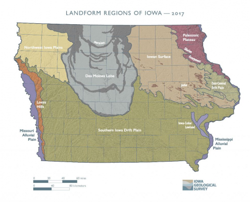
A landscape is a collection of terrain features, or landforms. Iowa’s landforms are composed of earth materials derived from glacial ice, strong winds, flowing rivers, and marine environments during the geologic past.
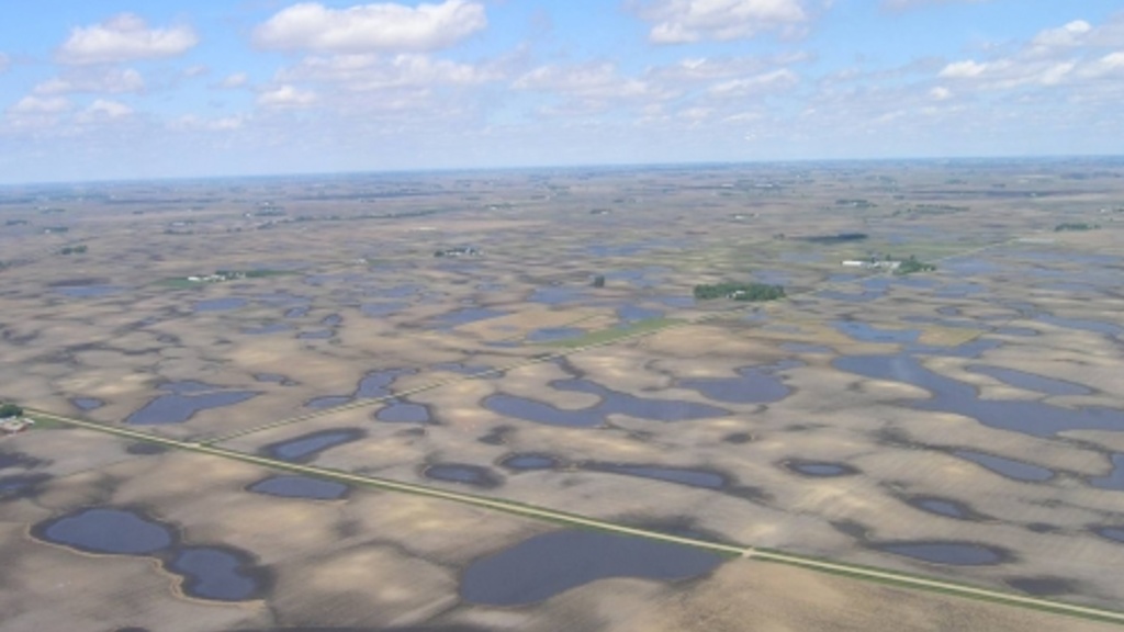
Des Moines Lobe
The last glacier to enter Iowa advanced in a series of surges beginning 15,000 years ago and reached its southern limit, the site of modern-day Des Moines, 14,000 years ago. By 12,000 years ago, the slowly decaying ice sheet was gone, leaving behind a poorly drained landscape underlain by pebbly clay as well as sand and gravel from swift meltwater streams. Today, broadly curved bands of ridges and knobby hills (moraines) mark the positions of stationary ice fronts. Clear Lake and Storm Lake lie along the lobe’s eastern and western borders. Iowa’s “Great Lakes,” smaller prairie potholes or kettle lakes, and abundant wetlands dot the terrain of this freshly glaciated landscape.
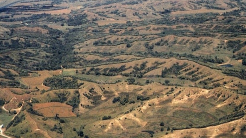
Loess Hills
Uncommonly thick deposits of wind-blown silt (loess) create a distinct landscape along Iowa’s western border. Seasonal meltwater floods carried the silt, finely ground by glaciers to the north, down the Missouri River. During low-flow periods, especially between 30,000 and 14,000 years ago, vast quantities of this loose silt were swept by wind from the broad valley and redeposited, with the deepest accumulation along its leeward margins. Subsequent erosion sculpted these deposits into an array of peaked hills and narrow ridges, with steep diverging side slopes, which now include sizeable tracts of native prairie.
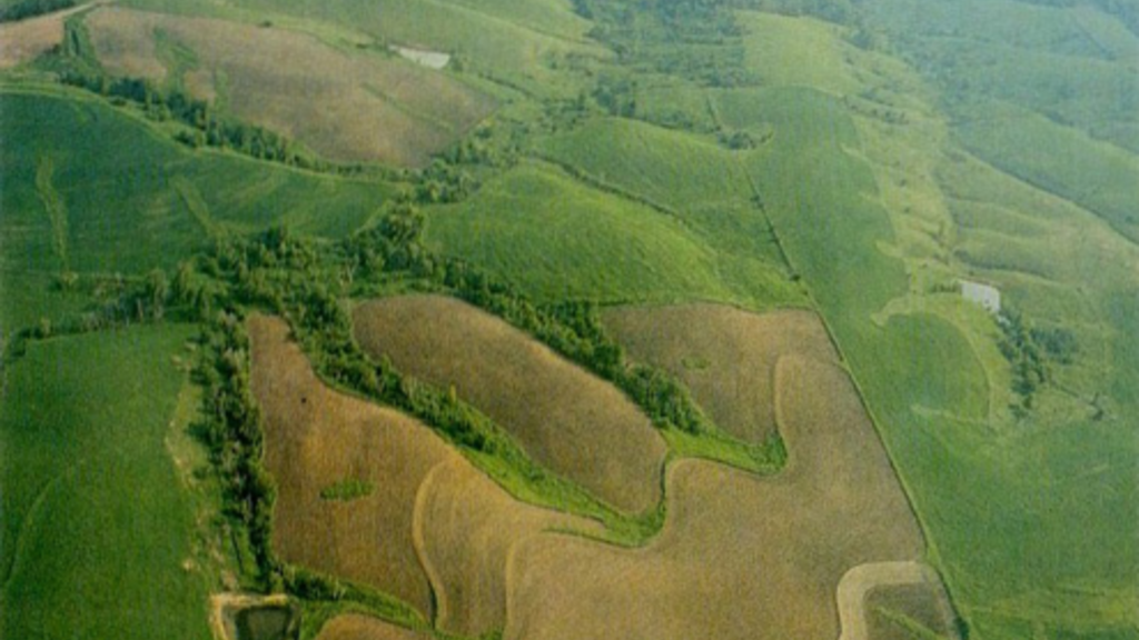
Southern Iowa Drift Plain
Older glacial deposits left by ice sheets that extended far south into Missouri over 500,000 years ago dominate this region. Deepening episodes of stream erosion carved these deposits so that only a horizon line of hill summits or occasional tabletop divides remain to mark the once-continuous glacial plain. Numerous rills, creeks, and rivers branch out across the landscape, shaping the old glacial deposits into steeply rolling hills and valleys. A mantle of loess drapes the uplands and upper hill slopes. The East-Central Drift Plain is a sub-region that includes shallow dolomite bedrock with sinkholes, wind-aligned sand and loess deposits, and significant local relief.
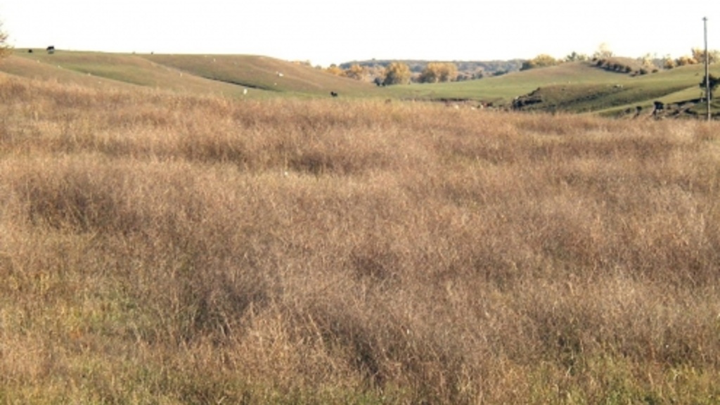
Northwest Iowa Plains
The open rolling hills of this region also result from the intense erosion that accompanied the period of maximum glacial cold. An abundant loess mantle adds to the region’s relief, a reflection of its nearness to the Missouri and Big Sioux river valley sources. Land elevations are uniformly higher and precipitation amounts lower than elsewhere in Iowa. Low wind-polished outcrops of reddish Sioux quartzite, the oldest bedrock seen in the state (1.6 billion years), occur in the far northwest corner of this region.
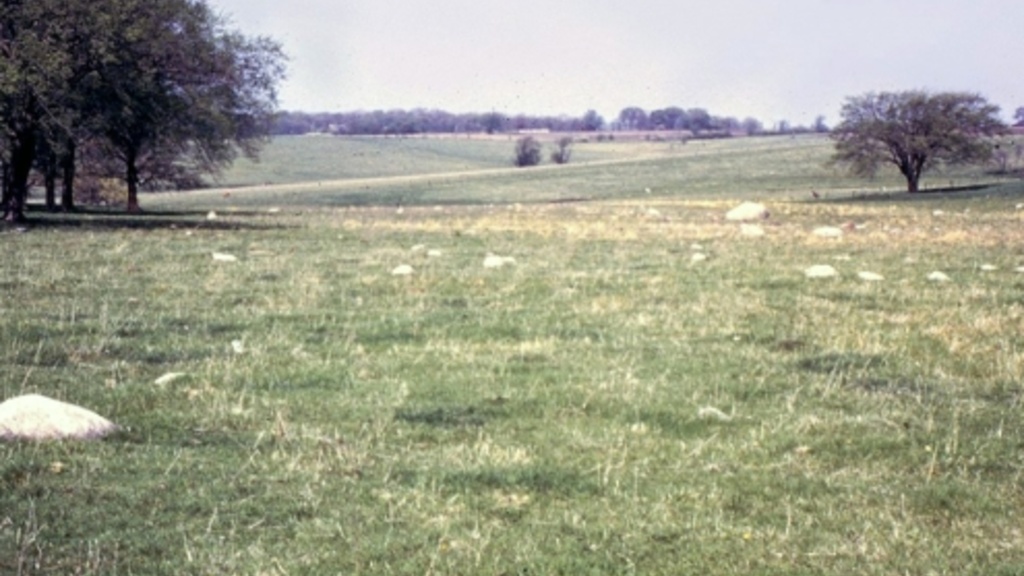
Iowan Surface
The gently rolling terrain reflects vigorous weathering during the last period of intense glacial cold, 21,000 to 16,000 years ago. Northern Iowa was not far from the ice front, and tundra and permafrost conditions persisted. Hilly landscapes leveled out as seasonal freezing and thawing loosened and moved sediments downslope. Exposed glacial boulders lie scattered across this landscape, and NW to SE trending loess-mantled hills (paha) and other linear features stand as uneroded remnants above the surrounding plain.
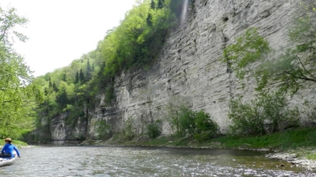
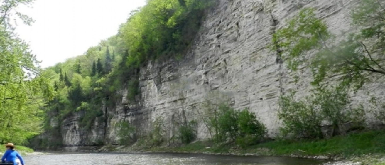
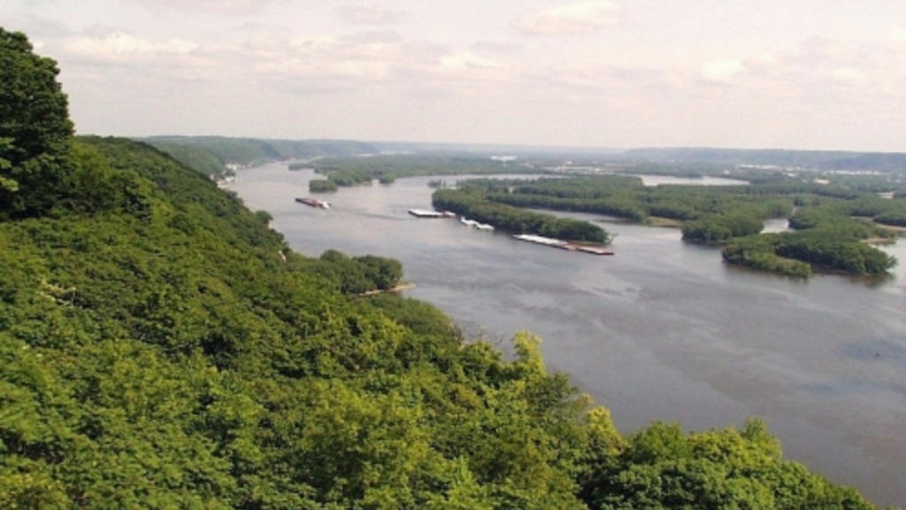
Paleozoic Plateau
The unusually scenic topography results from a near absence of glacial deposits and valleys that are deeply carved into sedimentary bedrock. Rock layers vary in resistance to erosion, producing picturesque bluffs, waterfalls, and rapids. Fossil-bearing strata originated as sediment on tropical sea floors between 300 and 550 million years ago (Paleozoic age). A prominent bluff line of resistant dolomite, the Silurian Escarpment, marks the western boundary of most of this region. Shallow limestone and dolomite, coupled with the dissolving action of groundwater, yield karst topography, characterized by numerous caves, springs, and sinkholes.
Alluvial Plains
Flowing rivers weave throughout Iowa, eroding and depositing sediment (alluvium) on their adjoining floodplains. Backwater sloughs and oxbow lakes in larger valleys mark former river channel meanders. Most rivers originated during melting of various ice sheets that covered all or parts of Iowa. Some alluvial plains (Iowa-Cedar Lowland) appear unusually wide for their river’s size, owing to the large volume of meltwater floods that once flowed through them. Larger river valleys may be fringed by sand dunes, shaped by the wind into linear and curved (parabolic) forms.