Hydrogeological research at IGS is critical for Iowans to better understand groundwater conditions in shallow and deep aquifers across Iowa.
Hydrogeology research at IGS is focused on evaluating groundwater conditions in shallow and deep aquifers across Iowa and bridging the intersection of groundwater quantity and quality with societal needs.
We work closely with the Iowa Department of Natural Resources (IDNR) and water suppliers across the state to assess groundwater aquifers, develop local and regional scale models and define critical source areas for groundwater protection.
Projects
Capture Zone Studies
Sponsor: Cities and municipalities in Iowa
Background: Many public wells in Iowa are threatened by nitrate concentrations approaching the maximum contaminant level of 10 mg/l.
Goals: Define priority acres for best management and conservation practices to reduce nitrate levels in public wells.
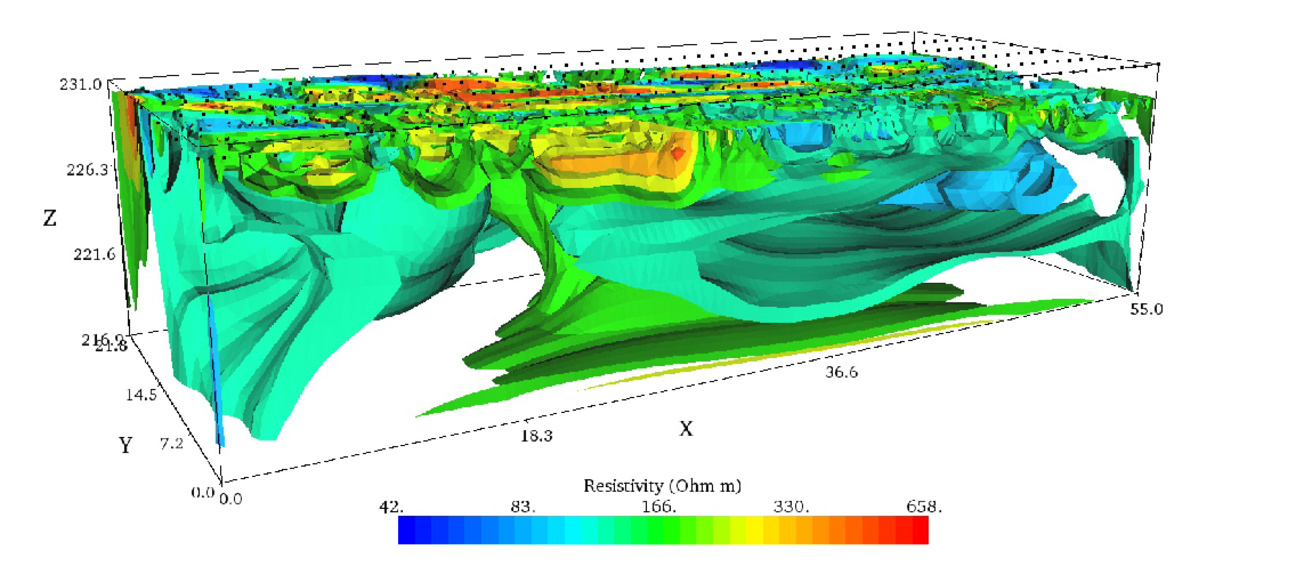
IGS Strategies: Hydrogeologic data from well installations, geophysics, and modeling can be used to develop groundwater flow models to more accurately define wellfield capture zones and prioritize areas for best management and conservation practices to reduce nitrate levels in public wells.
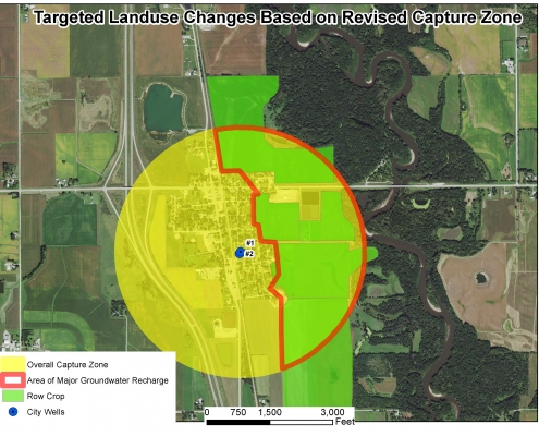
IGS hydrogeologists use the model to evaluate the extent of an aquifer, permeability and storage within an aquifer, groundwater flow direction and gradient, and sources of nitrate impacting a public water supply. With this information, IGS geologists can better define the extent of the groundwater capture zone, sometimes reducing it by as much as 90 percent. Improving capture zones allows targeting the installation of best management practices for improved long-term water quality.
For example, the IGS developed an accurate capture zone at Plainfield, Iowa, and convinced 100 percent of the landowners within the capture zone to use best management practices. Application of IGS research can significantly reduce nitrate concentrations in public drinking water supplies in a relatively short period of time.
Two Examples of Capture Zone Studies
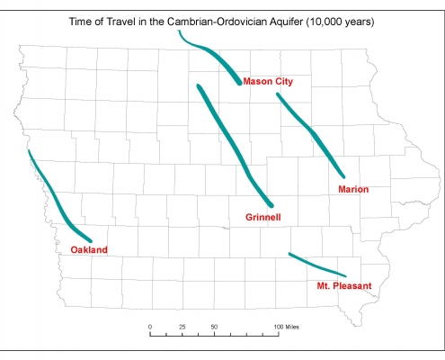
- Groundwater modeling and isotopic age dating indicated that the groundwater age in the Cambrian-Ordovician aquifer was more than 10,000 years old.
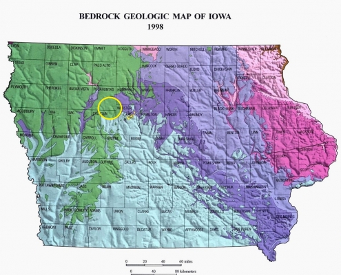
- IGS assessed groundwater flow and age at the town of Manson, Iowa, an impact site, determining that groundwater deep in the crater was very old.
Groundwater Travel Times and Age Dating
Determining the age of groundwater in an aquifer and the time it takes for groundwater to move in aquifers and confining beds both are critical research questions for Iowans. IGS evaluates groundwater conditions in a variety of geologic settings to unravel the mysteries of groundwater age and travel times.
For example, IGS researchers used isotopic age dating to provide an indication of the groundwater age in two deep aquifer systems in Iowa: the Cambrian-Ordovician aquifer and the Manson Impact Structure. In both studies, groundwater was found to be exceptionally old, on the order of several tens of thousands to more than 100,000 years.
Services
Hydrogeological research conducted at IGS is critical for Iowans to better understand groundwater conditions in shallow and deep aquifers across Iowa.
IGS staff members welcome research ideas and collaboration on these topics and other hydrogeological questions and issues that impact Iowans.
The IGS has a spectrum of hydrogeophysical capabilities that can be used to better understand and characterize Iowa’s groundwater and aquifers. Contact us to learn more (see below).
Contact Us

Keith Schilling
State Geologist and Research Scientist
Watershed Processes
PhD, University of Iowa
340A Trowbridge Hall
319-335-1422
keith-schilling@uiowa.edu