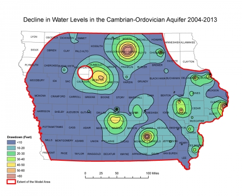
Although Iowa has abundant water supplies in general, recent demands for the state’s limited groundwater resources have intensified. Growing urban areas, ethanol production, large-scale livestock feeding operations, and industry are pumping groundwater out of the aquifer faster than it can recharge in some parts of Iowa.
IGS hydrologists have decades of experience using predictive models for potential research related to drought resiliency, aquifer storage and recovery, water sustainability, and nitrate. IGS researchers have developed groundwater flow models for four of Iowa’s regional bedrock aquifers. These regional numerical models allow researchers to forecast the future impact of changes in water usage and infrastructure.
Projects
Enhancing Groundwater Storage
Sponsors: Growing urban areas, ethanol production, large-scale livestock feeding operations, and industry
Background: IGS researchers can help water users cope with the intensifying flood-to-drought cycle by enhancing groundwater storage.
Goals: Help water managers achieve increases in groundwater recharge and storage through changes.
IGS Strategies: Provide a combination of strategies to help water managers achieve increases in groundwater recharge and storage through changes to infrastructure, including:
- Recharge basins
- Wetland construction
- Low-head dams on rivers and streams
Water captured behind these structures provides both surface water and groundwater storage.
River Systems
IGS hydrogeologists often use these strategies to support groundwater storage and recharge:
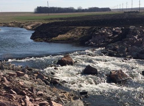
Riffle structures — Rock riffle structures raise the stage or water level of a river, which provides water to the aquifer, offering additional groundwater storage and recharge during a drought.
The higher the river stage, the greater the benefit to the aquifer. Rock riffles provide a gradual, environmentally-friendly gradient change.
Excavated channels — Former river channels are common in alluvial floodplains. These naturally-depressed areas can be excavated to current river levels to allow surface water to infiltrate and bring surface water closer to production wells. This increases groundwater storage and recharge.
Floodplain Systems
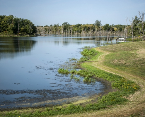
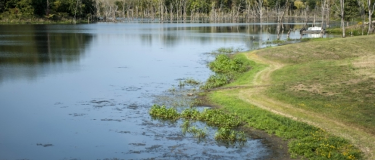
Basins — Excavated basins or existing gravel pits can be flooded to provide additional groundwater storage. Water in these basins infiltrates into the aquifer, allowing wellfields to maintain water production during a drought for multiple years, and reducing nitrate concentrations in the groundwater recharge.
Floodplain ponds — Floodplain ponds can improve water quality in an aquifer and provide a gradual source of groundwater recharge.
Land use/cover — Land use and land cover changes near a wellfield can affect water quality. Cover crops, riparian buffers, and other conservation practices can reduce nutrient and sediment loads in surface water, which feeds alluvial aquifers.
Services
The IGS has developed groundwater flow models using Visual MODFLOW and MODFLOW Flex for Iowa’s regional confined aquifers, as well as numerous alluvial aquifers across Iowa.
Numerical models can predict future impacts and overall water-level declines caused by increased water use. We can modify our regional flow models and recalibrate them at the county or city scale to assist communities and industries with long-term water supply needs, permit requirements, and potential well interference issues. We can also assist by evaluating overall water-supply infrastructure.
Our predictive models can also evaluate the feasibility of using deep wells for aquifer storage and recovery. This can help meet peak seasonal water demands.
Read more about IGS groundwater flow modeling.
Watch an interview with retired IGS hydrologist Mike Gannon.
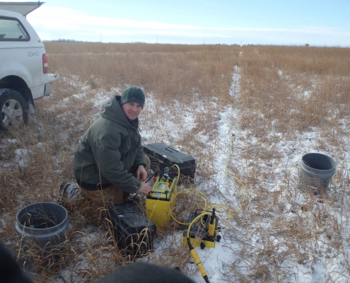
Aquifer characterization with geophysics
Electrical resistivity and seismic refraction can characterize alluvial, bedrock, and buried sand and gravel aquifers. Geophysics results, integrated with drilling record, geologic logs, and other site information can be used to develop a 3D characterization of the subsurface.
Pump test design and analyses
IGS pump tests provide information useful for water utilities and design engineers. Information can include pump size, future pumping rates and cycles, optimization of well spacing, potential long-term well interference and drawdowns, and critical input data for future groundwater model development.
Contact Us

Greg Brennan
Hydrogeologist
Groundwater Modeling and Water Resources Management
104 OIGS
319-335-4465
greg-brennan@uiowa.edu