Nestled in northwestern Iowa is an area known as the “Iowa Great Lakes.”
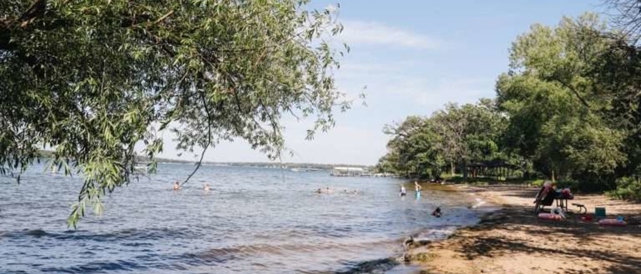
Historically, this region has been a popular vacation destination, yet few people realize it is also a showplace of geologic features that reflect the state’s most recent contact with glaciers. In Dickinson County, the curved, boulder-strewn shores of Gull Point State Park jut outward between Miller’s Bay and Emerson’s Bay into the deep waters of West Okoboji Lake. The park itself is surrounded by clusters of knobby hills, smaller lakes and bogs, and abundant sand and gravel deposits – all reflecting the last advance of glacial ice into Iowa.
Gull Point State Park and the Iowa lakes region occur along the southwest edge of an ice sheet that surged southward about 13,500 years ago, halting at what is now the city of Des Moines. This ice stagnated across the landscape and was followed by several smaller readvances over the next 1,500 years. The resulting topography in the lakes area is especially eye-catching because the younger glacial advances overlapped the older ice and merged to create widespread areas of high-relief, hummocky, “knob-and-kettle terrain.” The irregular hills of glacial debris associated with these compressed ice margins are laced with sloughs, bogs, and wetland “potholes” that formed in direct contact with the slowly disintegrating ice.
The Iowa lakes region also served as an important drainage outlet along the western edge of the melting ice sheet. One persistent route channeled meltwater southward past the Gull Point area, through the Okoboji Lake Outlet at its southern end, and into the Little Sioux River. Extensive sand and gravel deposits along this route are ample evidence of the huge volumes of water and sediment discharged by the melting ice.
Many other features in the vicinity of Gull Point State Park are products of the wasting ice. For example, Spring Run and Swan Lake-Christopherson Slough wildlife areas developed as a maze of tunnels within the disintegrating ice that funneled meltwater to the Okoboji Lake Outlet. Today, this drainage network is still intact, functioning as subtly linked sloughs and potholes connecting the hummocky uplands with the lower lying stream valleys.
Most lakes in this region are rounded, flat-bottomed and shallow, generally less than 20 feet deep. They likely formed as the glacial ice disintegrated and collapsed. West Okoboji Lake, on the other hand, is long and narrow in outline with numerous rounded embayments (Gull Point and West Okoboji Lake) and a maximum depth of approximately 135 feet – the deepest of Iowa’s natural lakes. It is thought to have formed along an already existing lowland which became occupied by an enormous block of the decaying glacier.
Coring of sediment accumulated in the western portion of Miller’s Bay reveals information about the region’s past climate. Fossil pollen grains and siliceous diatoms from these deposits show that a spruce and larch forest occupied the area as the ice melted. Over several thousand years, gradual warming occurred and a deciduous forest of oak and elm spread over northwest Iowa.
Prairie plants then expanded into the uplands as the climate became still warmer and drier, approximately 3,000 to 7,000 years ago. Lake levels were much lower than they are today. This extremely warm, dry period was followed by more modern climatic conditions; lake levels rose and deciduous woodlands reinhabited the lake margins.
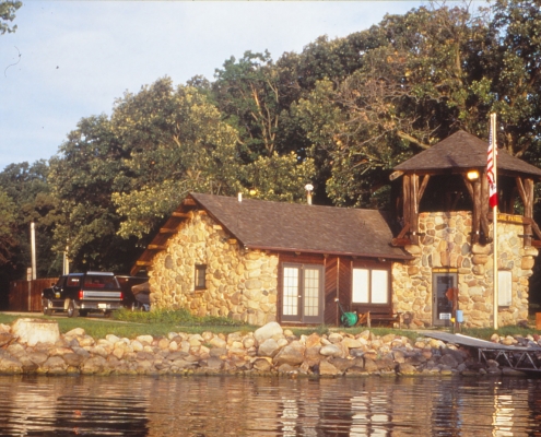
Large boulders are concentrated along the shoreline at Gull Point State Park. These travel-worn “erratics,” carried into Iowa by glacial ice, are usually igneous or metamorphic rock types, which are not native to Iowa. Reddish quartzite, granite and other crystalline rocks are common, and they reflect the massive power of glaciers and the northerly direction from which they came. These boulders are an impediment to agriculture, and in the Gull Point vicinity, field stones removed from crop ground often are seen piled in unused corners or along fence rows. Field stones are also used in building construction, and the beautiful rustic lodge and shore patrol station at Gull Point were built of glacial erratics having various shapes and mineral compositions by the Civilian Conservation Corps after the park was established in 1934.
Gull Point State Park and its surroundings highlight an important chapter of Iowa’s geologic history. Visitors are treated to the scenic beauty of natural lakes and wetlands, valuable wildlife habitat, and excellent examples of landscapes that reflect Iowa’s glacial heritage.
“Geology of Gull Point State Park,” by Lynette S. Seigley and Deborah J. Quade, Adapted from Iowa Geology 1996, No.21, p. 25-27.
Photos courtesy of the Iowa DNR