Photo courtesy of Iowa DNR
Travel south along Iowa Highway 1 through central Van Buren County, and you’ll sense a real difference in the landscape as you gradually descend a series of broad terraces into Iowa’s “Big Bend” country.
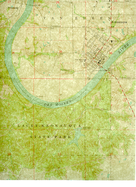
Level lowlands spread out ahead, ending against a forested bluff in the far distance. The sweeping bluff outlines a great bend in the Des Moines River and the beginning of Lacey-Keosauqua State Park. The park itself overlooks nearly two miles of the unusually large, 13-mile long loop in the Des Moines River, a major diversion from its dominantly southeastern course to the Mississippi River. This “Big Bend” segment of the river is steeped in both geologic and human history, for its past reaches back to the sandy floors of ancient seas and to the splash of pioneer wagons fording the river.
From the historic village of Keosauqua, visitors cross a vintage 1939 steel bridge that leads to the east entrance of the sprawling 1653-acre park. The view upstream is of the park’s extensive forest, mantling a steep bluff carved by the river’s flow. Beyond this bluff the park extends south, away from the river, and rises into level-topped uplands by way of numerous narrow ridges and steep ravines that drain to the Des Moines River. These dissected woodland habitats along a major river corridor make Lacey-Keosauqua one of Iowa’s premiere bird-watching localities.
It’s uncertain how long the Des Moines River has occupied this valley. The river’s first routes probably originated during melting of glaciers that covered southern Iowa over 500,000 years ago. The appearance of the present valley was affected by more recent meltwaters from glaciers in north central Iowa between 30,000 and 12,000 years ago, with final landscape touch-ups during the past 10,000 years. As today’s visitors hike the park’s roads and trails, the geologic history is seen in earth materials along the way.
The narrow ridge tops along the road and campground are mantled with a thin cap of loess, a yellowish-brown silt deposited by the wind 20,000 to 12,000 years ago. Down-slope from the ridge-tops, the ravines and small tributaries are carved into the older glacial deposits mentioned earlier, and these are best seen in scattered exposures along gullies and trail-cuts. Stones, referred to as “glacial erratics,” are eroded from the glacial deposits, and these cobbles dominate the rocks found in the upper parts of tributary streams. One such boulder-sized erratic in the western part of the park forms a monument dedicated to Major John Fletcher Lacey, honoring his work in conservation earlier this century.
Below the glacial deposits, the sides of the river valley steepen considerably, as they are cut into bedrock which is much more resistant to erosion. Bedrock outcrops are seen along the lower reaches of Wesley, Thatcher, and Ely’s creeks as well as along the Des Moines River. The interbedded sandstone, limestone, and dolomite are about 325 million years old (Mississippian age; see Bedrock Geology map of Iowa).
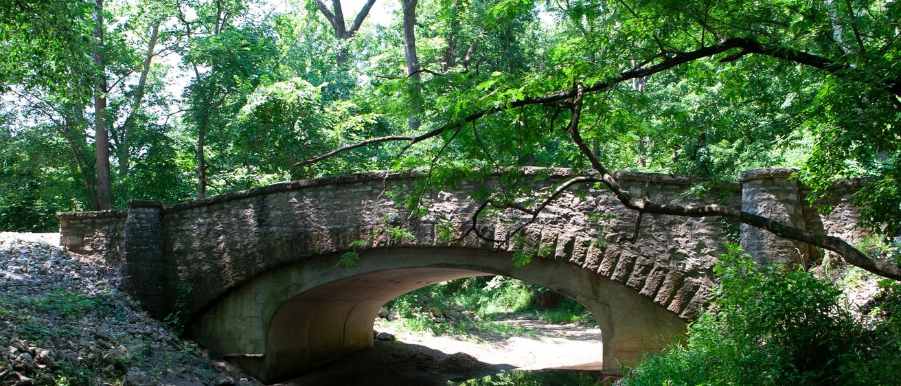
The bedrock formations seen by most visitors include the Keosauqua Sandstone and the overlying Pella Limestone which form large cutbank outcrops in the area where the main park road crosses the creeks. The Keosauqua Sandstone, referred to as such in 1895 by C.H. Gordon in his report on the geology of Van Buren County, forms the largest outcrops in the park. This tan sandstone, up to 25 feet thick, displays well-preserved cross-stratification, a feature that reflects its origin as large ripples on the sandy floor of an ancient shallow sea. Hikers along the main river trail cross this rock formation in several places, and picnickers at Ely’s Ford, an historic river-crossing, can walk along a cool sandstone-lined glen upstream of the footbridge. Canoeists and boaters see the best exposures of Keosauqua Sandstone along the base of the big bend bluff, where the swift current has carved vertical rock walls. A still older brown dolomite, belonging to the St. Louis Formation, also is exposed here but only during low-water stages.
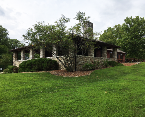
While the Keosauqua Sandstone may be the most obvious rock formation in the park, park-goers will also be drawn to the beautiful historic stone structures originally constructed by Civilian Conservation Corps (CCC) work crews during the Depression Era. Two distinct types of stone were used, the brown dolomite of the St. Louis Formation, taken from quarries west of the park along Chequest Creek, and the younger light-gray limestone of the Pella Formation quarried within the park from ledges exposed along Wesley Creek.
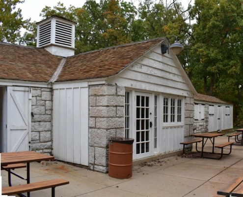
The picnic shelters and park residence are built of the brown dolomite, while the bridges, stone lodge, and lake bath house are constructed from the lighter-colored gray limestone. This light-gray to white, fine-grained limestone is the product of a clear-water shallow sea, and is well-suited to dimensioning for building stone. The limestone was extracted from several Keosauqua area quarries during the 1800s and early 1900s. The historic CCC quarry along Wesley Creek within the park, while somewhat overgrown, is still accessible by foot, and while walking along the sun-drenched quarry ledges examining the air-drilled holes, one can easily imagine industrious young crews landing their sledges on the splitting pins.
Lacey-Keosauqua State Park is an example of conservation foresight, historic construction projects, and southeast Iowa geologic history. It is a jewel in the state park system and well worth a trip into Iowa’s “Big Bend” country.
Photos courtesy of the Iowa Department of Natural Resources
See original article titled, “Lacey-Keosauqua State Park, Iowa’s Big Bend Country,” by Robert McKay: Iowa Geology, No. 22, 1997, p. 22-27.