Photo courtesy of Iowa DNR
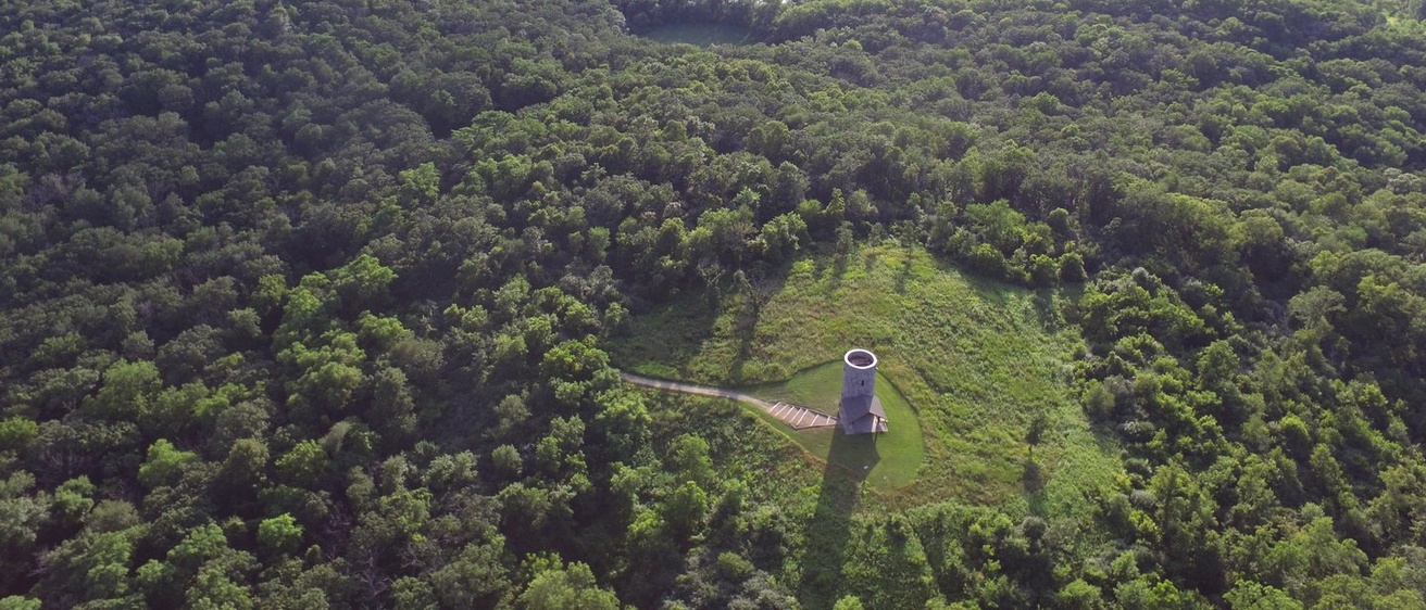
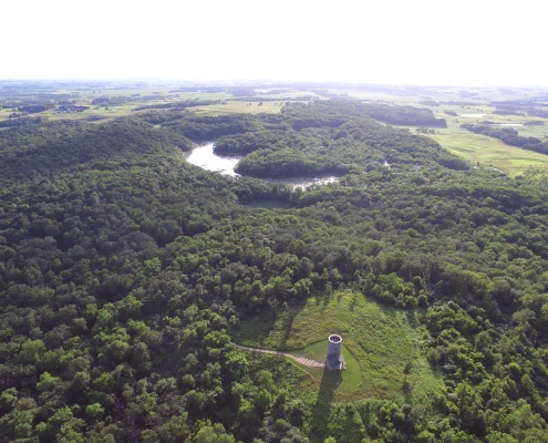
One of north central Iowa’s most prominent natural landmarks is easily seen along Highway 9 across southern Winnebago County. Pilot Knob, an isolated cone-shaped hill, rises 250 feet above the surrounding terrain and provides a commanding view of the Iowa countryside.
For early settlers, the mounds and knobby hills of this region served as “pilots” for those navigating the expansive unmarked prairie, and the most prominent of these became known as Pilot Knob. The conical hills, irregular ridges, and interlaced wetland swales all reflect the area’s recent contact with glaciers.
Pilot Knob State Park lies along the eastern margin of a former ice sheet that surged into Iowa about 15,000 years ago and reached its most southern extent, at the present location of Des Moines, about 14,000 years ago. This ice sheet and the deposits it left behind are referred to as the Des Moines Lobe. After the initial glacial surge, the ice became stagnant across the north central Iowa landscape. This was followed by several less extensive re-advances over the next 1,500 years.
Along the lateral margins of the lobe, stagnant ice from the older Altamont advance was overridden by younger, re-advancing Algona ice. This action created broad areas of high-relief hummocky topography, better known as “knob and kettle terrain,” which is characteristic of the park and vicinity.
The landscape we see today is a topographic reversal of the former ice-covered landscape. Today’s knobby hills represent former cavities and crevices within the ice. Glacial meltwater was funneled into these holes in the disintegrating glacier, filling the openings with sand and gravel. Subsequent melting of the ice left hills or knobs of sand and gravel known as kames. Kames are classic ice-contact glacial landforms, and they typify the Pilot Knob State Park region. Kettles, closely associated with kames, are bowl-shaped depressions that also illustrate the reverse of ice-covered terrain. Kettles formed when large, buried blocks of ice melted from the landscape.
The nearby Winnebago River was a drainage outlet during melting of the Algona ice advance. The outwash deposits of sand and gravel along the river are referred to as “valley-train” deposits because they were left by meltwater flowing in a long, narrow route away from the edge of the glacier.
Another landform feature associated with melting of the Des Moines Lobe glacier is Deadman’s Lake. Actually, recent studies have identified this feature as a fen, a relatively rare type of peatland that is fed by groundwater as well as rainwater. The 25-acre wetland is nestled among sandy knobs within the park. Most likely, the basin formed during melting of the Algona and Altamont ice advances. Deadman’s Lake (photo below) is unique in that its western portion has a three-acre floating mat of vegetation dominated by Sphagnum moss. At one time, this mat covered most of the lake; however, harvesting during the late 1920s greatly reduced its size. Other unusual plants associated with the floating mat include a rare species of sedge (Carex cephalantha) and the sundew (Drosera rotundafolia), which are not found elsewhere in the state.
Since the last glacial episode, many changes have occurred in the vegetation assemblages at Pilot Knob. Studies of fossil pollen grains in soil cores collected from Deadman’s Lake indicate that vegetation around the lake changed from oak savanna to prairie about 8,000 years ago. By 3,000 years ago, the prairie was replaced by oak forest. Evidence of the more recent European settlement became apparent with the appearance of certain “weeds,” primarily Ambrosia (ragweed).
Reports from early visitors indicated that the Pilot Knob area was at least partially wooded. Forest and prairie apparently co-existed in the knob and kettle terrain throughout Hancock, Winnebago, and Worth counties, primarily because the oak-covered knobs were protected from fire by intervening wet depressions.
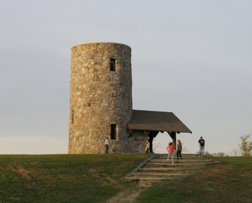
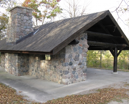
Pilot Knob State Park was officially dedicated in 1924, after a coalition of local citizens took the initiative to preserve the area for future generations. In 1934, Civilian Conservation Corps workers began building and landscaping projects at the park. Within four months, they had constructed roads, trails, a rock shelter, an outdoor amphitheater, and the 35-foot observation tower (photo at beginning of article). Glacial erratics (boulders transported by ice) were collected from nearby fields for construction of the buildings and tower. These erratics consist mostly of igneous and metamorphic rocks that originated in Minnesota and Canada. In 1968, the entire park (365 acres) received State Preserve status, and in 1978, an additional 160 acres was acquired for parkland.
Pilot Knob State Park still serves as a modern-day landmark for travelers crossing the former expanse of north central Iowa prairie. The gravel hummocks and sparse stands of burr oak reflect Iowa’s past glacial and vegetation history, and create the scenic beauty for which Iowa’s knob and kettle country is known.