Wildcat Den State Park encompasses 417 acres along the Pine Creek drainage in Muscatine County, between Muscatine and Davenport.
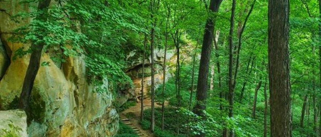
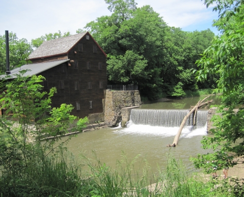
It is an area of exceptional beauty marked by imposing sandstone exposures. The park was formally dedicated in 1935 to preserve its scenic geology, diverse plant communities, archaeological resources, and historic sites. The restored Pine Creek Grist Mill, constructed in 1848, is one of the finest examples of a mid-19th century grist mill to be seen anywhere in the country. A series of well-maintained hiking trails affords the visitor easy access to many points of interest.
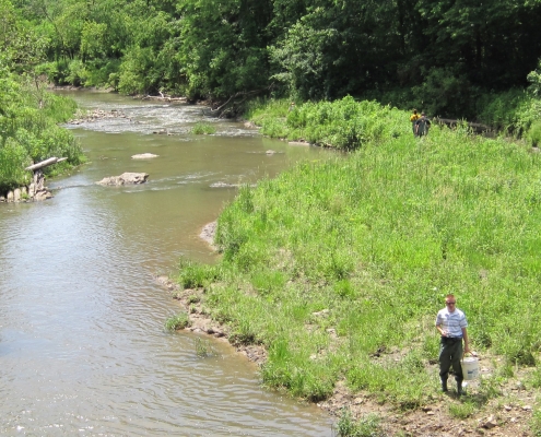
An array of geological resources in the park provides fascinating glimpses into Iowa’s ancient past. The oldest bedrock, exposed along the margins of Pine Creek, includes about 25 feet of fossiliferous limestone and dolomite (“magnesian limestone”) of the Cedar Valley Group. These rock layers formed from lime sediments that accumulated in shallow tropical seas that covered the region during the Devonian Period about 375 million years ago. The Devonian strata are best displayed below the dam next to the grist mill, where the beds are disrupted by small-scale faulting. Fossil corals, stromatoporoids (extinct sponge-like animals), fossil brachiopod shells, and skeletal pieces of crinoids (“sea lilies”) are preserved in the bedrock along Pine Creek.
A considerable hiatus in the geologic record separates the Devonian strata from the overlying Pennsylvanian shale and sandstone units in the park. These Pennsylvanian strata reach thicknesses of about 100 feet and accumulated during the so-called “Age of Coal.” During this geologic period, eastern Iowa straddled the equator, and humid tropical forests stretched along ancient river courses and coastal lowlands that were present. Swamps accumulated masses of vegetation, later to become coal. Salt-water estuaries encroached up the river valleys, as evidenced by brackish-water fossils and by sediments that reflected tidal rhythms. Deposits of gray shales and mudstones accumulated about 315 million years ago, yielding the soft rocks of the Caseyville Formation, which typically form overgrown soggy slopes along the lower valley walls of Pine Creek. The shales contain abundant organic material, and fossil ferns and “scale tree” foliage have been identified within the park. Thin coal beds are also associated with this formation at Wildcat Den and in nearby areas of Muscatine County.
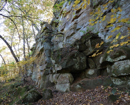
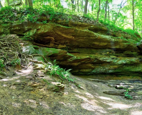
Picturesque sandstone cliffs and glens form the most noteworthy landscape features of Wildcat Den State Park. These sandstones belong to the Cherokee Group and were deposited about 310 million years ago (during Middle Pennsylvanian time), subsequent to the underlying shales and mudstones. These strata contain the bulk of Iowa’s coal resources, known especially from south-central Iowa. Springs and seeps occur at the contact between the porous Cherokee sandstone and the underlying, less permeable Caseyville shale (e.g., iron-rich springs near the base of Steamboat Rock).
The sandstones were deposited in ancient river channels and record multiple episodes of erosion and deposition. Crossbedding of the quartz sand is prominent, and records the general southwesterly direction of flow within the rivers. In some places, iron-oxide cements form dramatic swirls and bands in the sandstones, and these are related to later chemical precipitation from mineralized groundwater. The delightful sandstone precipices and ravines spur our imaginations with a variety of images, reflected in part by the fanciful names that have been given to some of the prominent features, including Steamboat Rock, Devil’s Lane, and Devil’s Punchbowl.
Later chapters of the geologic history of Wildcat Den State Park are interpreted from more recent sediments that mantle the bedrock. The area was overridden by continental glaciers several times during the Pleistocene “Ice Age.” The most recent of these was the Illinoian glaciation which spread from Illinois into easternmost Iowa about 300,000 years ago, displacing the ancestral Mississippi River channel westward into eastern Iowa. Remnants of these glacial sediments are scattered in the park’s upland areas.
The most recent glacial advance (Wisconsinan) pushed southward across northern Iowa and areas of Wisconsin and Illinois, but did not reach into eastern Iowa. However, deposits of wind-blown silt (loess) did blanket much of the area and were derived from river valleys that carried huge volumes of sediment-laden glacial meltwater. Two silt units are recognized at Wildcat Den. The older Roxana Silt dates from about 55,000 to 28,000 years ago. The overlying Peoria Loess, which accumulated between 21,000 and 12,000 years ago, is typically about 20 feet thick in the uplands of the park.
Other important landscape changes occurred between 25,000 and 11,000 years ago, as eastern Iowa began to assume a more familiar form. Of special note, the channel of the Mississippi River shifted to its present location between Rock Island and Muscatine, and the modern stream drainage configuration began to develop.
The most recent aspects of the geologic evolution of Wildcat Den are found in the sediments, landforms, and cultural remains of the Holocene, the last 10,000 years. The advent of intensive agriculture and settlement in the area over the past 150 years have also modified the landscape and stream courses.
As we visit Wildcat Den State Park today, our experience is enriched by an appreciation of the history contained in the rocks, sediments, and landforms. Wildcat Den will serve as a clear reminder of our state’s natural heritage for generations to come, a proud connection to this land we call Iowa.
“Geology of Wildcat Den State Park,” by Brian Witzke, in Iowa Geology, No. 24, 1999, p. 16-19.
Photos by Iowa DNR and Jackie Hartling Stolze