Phil Kerr, IGS Geologist
Why is it that some people seem to have all the luck? It seems every spring some folks have to go out and pick stones out of their fields while others don’t have that issue. For example, consider Benton County. The fields northeast of the Cedar have loads of fieldstones, while those closer to the Iowa river oftentimes have little to none. The difference between the two areas is whether the areas are dominated by thick windblown silt (called loess) or glacial sediment which contains the fieldstones. So the question really boils down to why do these two regions differ so much?
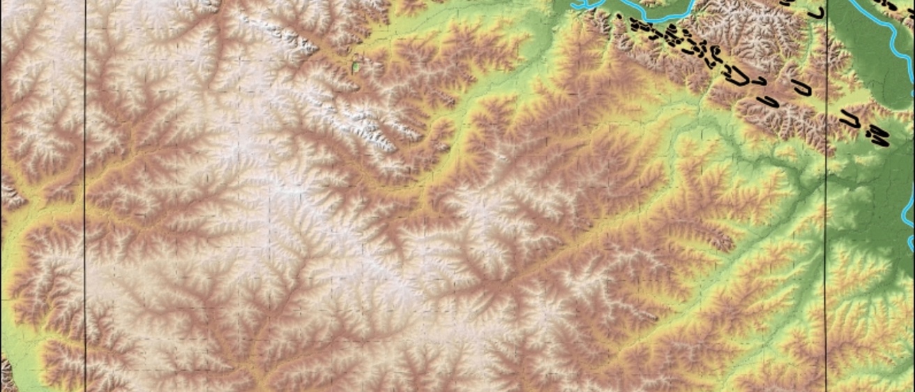
The answer has to do with changing Iowa’s landscape. It has been reshaped throughout geologic history and the most change was from numerous continental ice sheets. Since the ice retreated, the landscape has undergone fluvial incision and the glacial deposits have experienced weathering and soil development. One of the most common materials left on the landscape from the last glacial period is wild blown silt, or loess. Benton County was recently mapped and is a fine example of the complexities of landscape development. During the Wisconsin Episode (the last glacial period), the Cedar and Iowa received massive amounts of sediment from the Des Moines Lobe. Wind picked up loess from the sediments in these valleys and draped it on the landscape. At the same time, however, eolian sand was also saltating across the surface and deflated (sandblasted) the loess where not impeded.
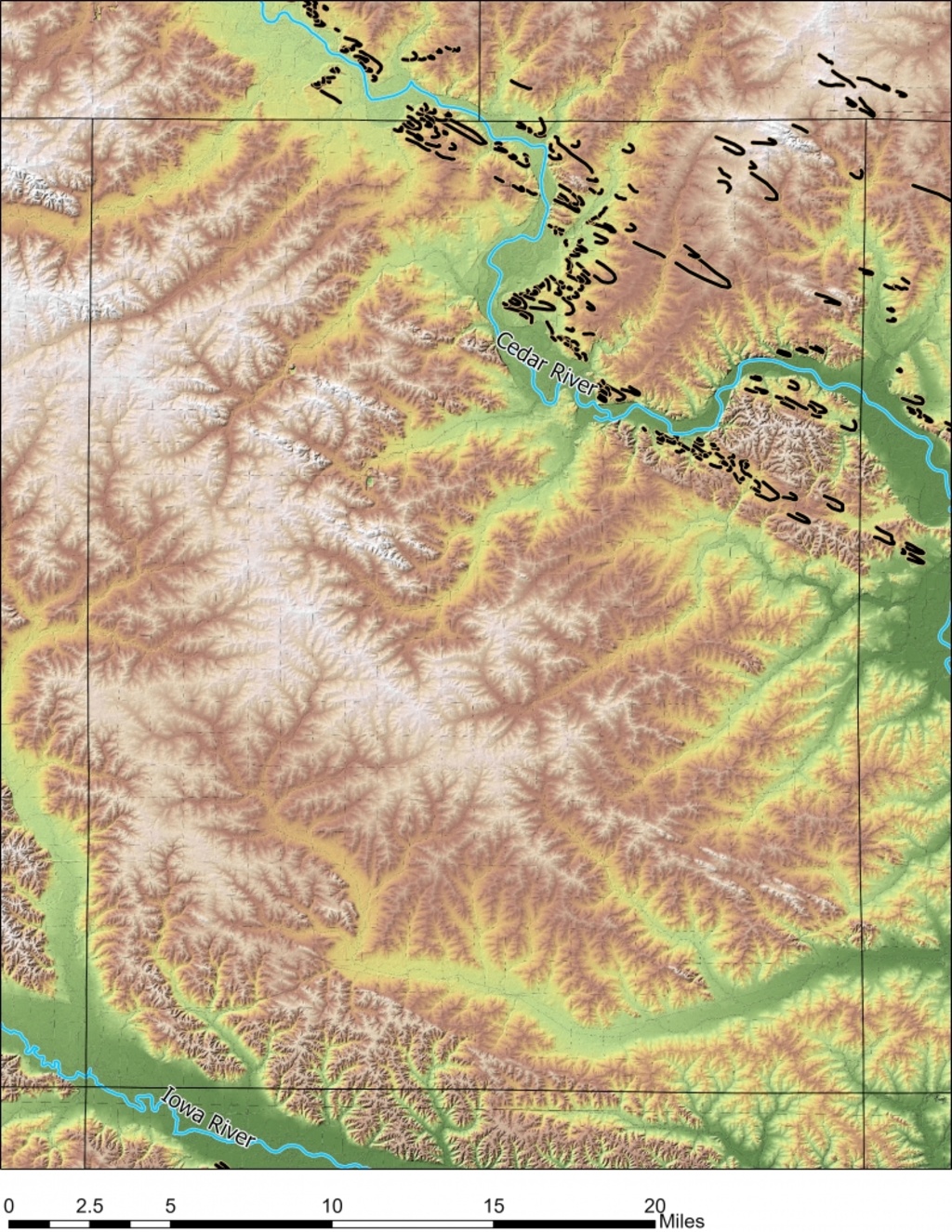
The key factor on loess thickness is the orientation of the landscape with relation to the west northwest- the direction of the effective wind during the Late Wisconsinan. Numerous parabolic dunes in the area were used to reconstruct the wind direction. All the dunes in Benton County show the wind was from the WNW during their formation. Their sand was from outwash carried by the Iowa and Cedar rivers which was likely source for most of the loess as well. Blowing sand has energy and areas where saltating sand could leave the river channel is largely loessless downwind. The Cedar River Valley has many turns in its course and its valley geometry is controlled by the underlying material. The river valley has sections with outcropping bedrock and thick glacial sediment. The bedrock sections have steep walls which would block sand from leaving the valley, but areas with no bedrock in the valley have broad flood plains where the sand was free to blow out. As expected, these flat, bedrock-free stretches have extensive sand sheets and parabolic dunes downwind with little loess downwind.
The Iowa River, however, was more overall in line with the WNW wind for most of its course from the Bemis Moraine of the Des Moines Lobe to the Devonian outcrop belt in Johnson County. The alignment kept most of the sand from leaving the valley, even though it was not lined with bedrock. This contrasts with the alteration between steep and shallow valley form due to the winding course of the Cedar River. Eolian features and deposits in Benton County reinforce the idea that eolian processes helped shape eastern Iowa in a large way. The windblown sand and show that eolian processes during the Wisconsinan were a dominate force affecting the modern topography of the area. The southern boundary of the Iowan Surface is in large part due to the Iowa River funneling sand along its channel while its tributaries caught sand due to their deep incision.
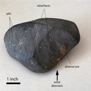
So the reason why some farmers near the Cedar River in Benton County have to pick fieldstones in the spring is due to the sand kicking up all the loess during the last glacial period. Spots where sand couldn’t blow had loess bury the glacial till and the fields there are largely rock free. So next time someone asks to lend a hand moving field rocks out of their back 40, look at the rocks and see if you can find a ventifact (picture). These stones show the force of the sand and were scoured for thousands of years. Take it from me, they make better paper weights than top soil!