Stephanie Tassier-Surine (stephanie-tassier-surine@uiowa.edu), Iowa Geological Survey, University of Iowa
People are often fascinated by maps, whether it’s a road map, a historic places map, or a weather map. People may be drawn to a map for its visual appeal or for the practical purpose of the information it contains. The same is true of a geologic map. While being aesthetically pleasing, they also provide valuable information to the user. Simply put, a geologic map is a way to present data and ideas.
Constructing a geologic map is a fundamental activity of a geologic survey. Examples include bedrock or surficial geologic maps, water resource maps, geologic hazard maps, or soil nutrient maps. IGS geologists assemble existing data, collect new data to fill in gaps or confirm ideas, and synthesize and interpret this information to address the question being asked. IGS geologists may evaluate thousands of data points to construct a geologic map. Data may include well drilling records in the IGS GeoSam database (https://www.iihr.uiowa.edu/igs/geosam/map), newly drilled IGS core holes, outcrop information, and past data reposited in reports and guidebooks.
IGS geologists have state-wide knowledge of materials and resources, and as such may synthesize data in ways that helps a local user who may not be able to compile that information on their own. Traditional surficial and bedrock geologic maps give information on the extent and thickness of a unit as well as its characteristics such as lithologic properties (rock type and size of grains), porosity and permeability (how well a material stores and transmits water), and durability (how likely is the unit to break down). By knowing where a resource is located, and how difficult it may be to access, maps can help the planning process to assist with resource management and sustainability. Derivative maps, which are constructed with the intent of answering more specific questions, help guide decision making. They may include depth to bedrock or groundwater vulnerability maps.
The IGS mapping program is partially funded by the United States Geological Survey (USGS) National Cooperative Geologic Mapping Program (STATEMAP). This competitive grant program is a 50:50 match of state and federal funds. A 25-member advisory panel of individuals from the public, private, and academic sectors help prioritize mapping areas and identify future areas of concern. Current mapping priorities focus on impaired watersheds and developing areas.
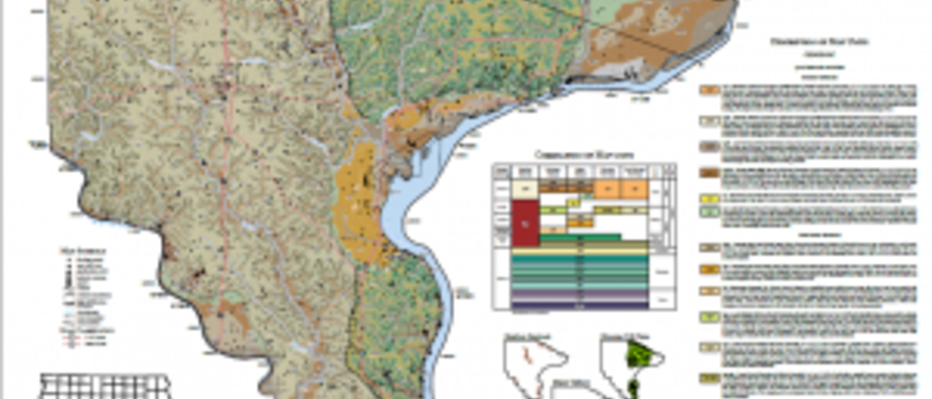
The IGS completed bedrock and surficial geologic maps of Lee County in 2022. This project also included bedrock elevation and quaternary thickness (the depth to competent rock) maps.
Current mapping projects are located in Des Moines, Muscatine, and Black Hawk counties. Previously published maps are located on the IGS publications site: https://www.iihr.uiowa.edu/igs/publications/publications?category=Open-File-Maps-(digital-maps)
Geologic maps have tremendous societal, economic, and educational value. Bedrock and surficial geologic maps may be used to assist in aggregate resource evaluations, flood protection, hazard identification (sinkholes and karst), and water resource assessments. Water resource maps may aid municipalities or industry to locate water of sufficient quantity and quality to meet their needs. Hazard assessment maps may provide critical data to the Iowa Department of Transportation or county engineers to mitigate infrastructure failure and evaluate road expansion projects. While these products may seem like ‘just another map’, their benefit to society is far reaching.