Elliot Anderson, Postdoctoral Research Scholar
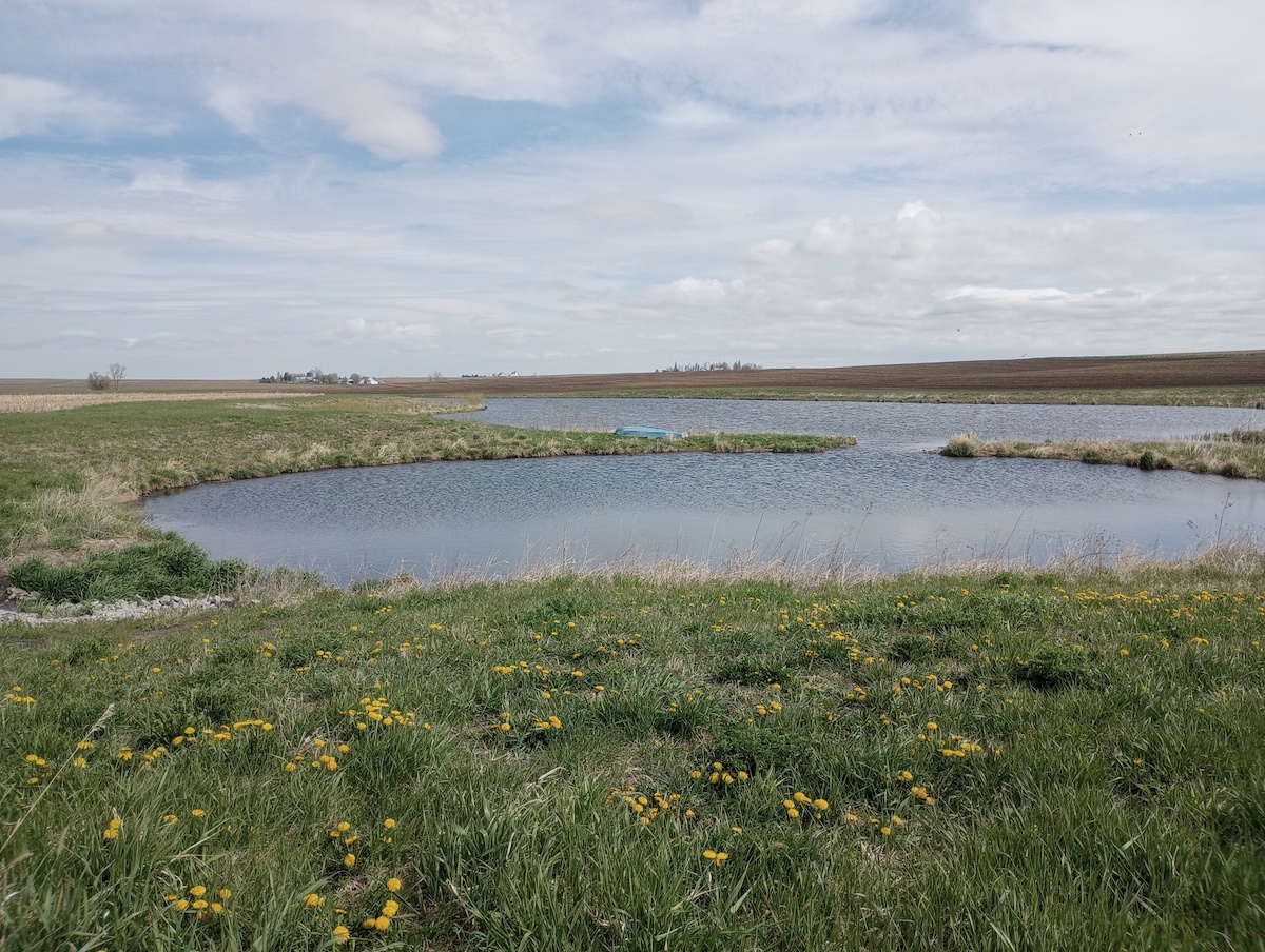
Anyone who has driven across Iowa knows that the state is dominated by agriculture. But among the fields lined with corn, soybean, and livestock, a new feature is becoming more common: wetlands. Wetlands are ecosystems where the soils are saturated by water on a permanent or seasonal basis. They contain unique sets of plants suited to saturated soils and foster environments with much greater biological diversity than the typical Iowa landscape. Wetlands are found across the world and come in all shapes and sizes. Bogs, swamps, and marshes are all types of wetlands, but in the Midwest, wetlands usually take the form of prairie potholes, oxbows, fens, and floodplain depressions.
Wetlands were once widespread in Iowa but are now relatively uncommon. Most of Iowa’s original wetlands were drained for crop production, and this shift has fundamentally altered Iowa’s hydrology. Many natural processes and functions provided by wetlands were removed from the landscape. Wetlands provide unique environments for plants and animals and improve water quality by trapping incoming sediment and creating biogeochemical conditions that naturally degrade many waterborne pollutants. Wetlands also reduce flood risk by promoting infiltration and holding back flows during large rain events. Wetlands further provide opportunities for recreation and offer stakeholders a chance to enjoy Iowa’s landscape.
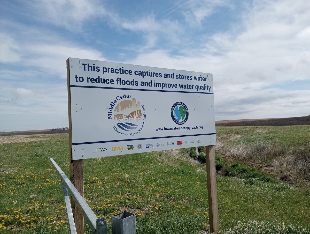
While many natural wetlands have been removed, many artificial ones are now being created as part of water quality improvement efforts. In agricultural areas, wetlands have been constructed to intercept and treat water running off farm fields or flowing through tile drainage lines. These constructed wetlands are especially suited to removing nitrate, a common pollutant that impairs drinking water and causes algal blooms that disrupt aquatic ecosystems. The mixture of submerged vegetation and slow-moving water creates an environment where microorganisms consume nitrate and convert it into nitrogen gas, which is environmentally safe. While the constructed wetlands are known to work, their effectiveness can vary across sites, so it is important when the opportunity arises to quantify the amount of nitrate the wetland removes. Stakeholders are keen to know the water quality improvements a given wetland produces so the design and understanding of these structures can advance.
The IGS has a long history of monitoring water quality improvement practices. In 2021, we began collaborating with Professor Craig Just (Environmental Engineering faculty at the University of Iowa) on a newly constructed wetland near Vinton, IA. Through a grant provided by the U.S. Environmental Protection Agency, Just’s team designed and modeled a wetland in the Mud Creek watershed—located about 20 miles northwest of Cedar Rapids. When the wetland was constructed, the IGS developed a monitoring protocol to measure its effectiveness.
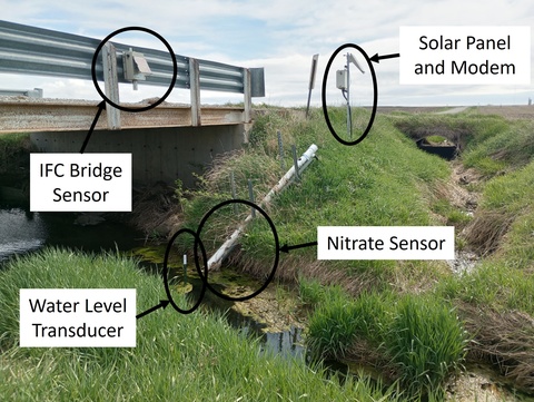
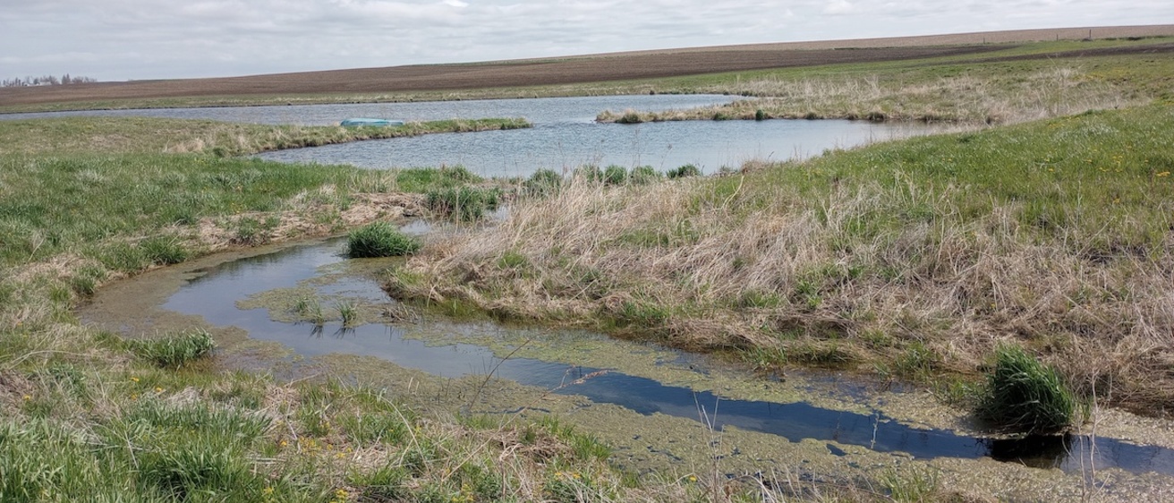
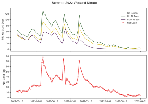
Determining the amount of nitrate removed by a wetland is a mass balance exercise. We calculate the nitrate flowing into and out of the wetland, and the difference between these two values is the net load (the amount of nitrate removed). Our area of interest lies along Mud Creek, and this waterbody carries a substantial load of nitrate into the wetland. To estimate the nitrate mass, we deployed several pieces of equipment on-site to measure the water’s flow and nitrate concentration (Figure 1). Our setup included a sensor that measures nitrate concentrations and a water level transducer that provided stream depth every 15 minutes. Using the local channel geometry, we converted stream depth observations into flow values. This information was transmitted using an on-site modem to an online database where measurements can be viewed in real-time. Additionally, a bridge sensor provided by the Iowa Flood Center (IFC) monitored the water level during high flows. The IFC sensor provides warnings about extreme weather that might require maintenance of the wetland or damage equipment.
Several tile lines drain into the wetland directly. To quantify their nitrate input, we collected grab samples of these lines and measured their flow every two weeks. The grab samples were then tested for nitrate at a local laboratory. Multiplying the corresponding flows and nitrate concentrations yielded the mass of the nitrate for a particular tile line. By summing the nitrate from the main channel of Mud Creek and the various tile lines, we estimated the amount of nitrate entering the wetland. A similar setup was used at the outlet to quantify the amount of nitrate leaving the wetland.
Figure 2 shows the results from the summer of 2022. The wetland removed 2,600 tons of nitrate (~ 51% of all the nitrate that entered it). Monitoring occurred throughout 2023, and the IGS is currently working with Prof. Just to analyze and publish the final results. As the wetland’s vegetation continues to mature, we expect the wetland to remove an even greater percentage of nitrate in the future. IGS appreciates the opportunity to collaborate with Prof Just and his team on the wetland project, and we will look to collaborate with other researchers to document conservation efforts made to improve our water quality.