Jason Vogelgesang, IGS Geophysicist
The Iowa Geological Survey (IGS) resides within the same institution as the Iowa Flood Center (IIHR Hydroscience and Engineering), and our organization is well aware of the risks flooding can pose to Iowans and property. Levees, embankments designed to prevent the overflow of a river into surrounding infrastructure, serve a vital role in protecting Iowans from loss of life, livelihood, and economic setbacks. Flooding has impacted all of Iowa’s 99 counties since 1988. The major flooding events of 1993 and 2008 come to mind as significant examples, costing the state billions of dollars in damage and lost economic opportunity.
Iowa has approximately 700 miles of levees protecting towns, agricultural land, and other infrastructure. Assessing the condition of levees is a critical component to ensure they remain strong during flood events. The IGS recently established methods to use geophysics to image levees via a pilot investigation with the Iowa Department of Homeland Security and Emergency Management. Anomalies discovered by geophysics can inform levee managers of possible areas of weakness, such as the presence of porous materials, voids, or areas susceptible to underflow.
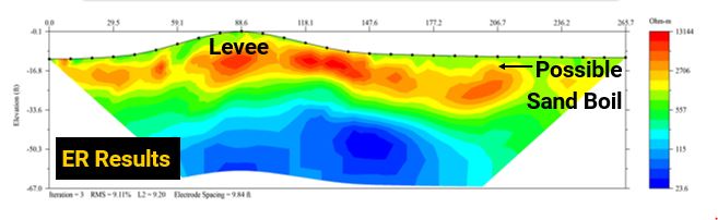
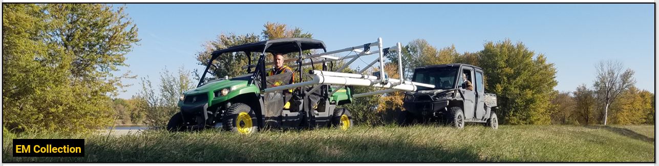
To accomplish geophysical imaging of levees, the IGS uses electromagnetic terrain conductivity (EM) imaging, which is an effective way to measure the conductivity of the subsurface. Top-of-levee and toe slope surveys scan for anomalies up to 20 feet below the surface and are collected via an all-terrain-vehicle. Electrical resistivity tomography (ER) surveys provide additional details in areas flagged by EM. ER results are shown in cross-section view and provide information about the depth and extent of anomalous zones. To fully image a levee system, the IGS: 1) collects EM data along the top and toe slopes of the levee, 2) follows up with ER surveying in flagged areas, and 3) creates a map showing anomalous areas. The final map and results are followed up with the levee authority to determine what type of preventive action should be taken in each area.