New Information on Glacial Advances in Iowa
The IGS has been working to define the timing and distribution of the mid-Wisconsin Sheldon Creek Formation in Iowa for nearly 10 years.
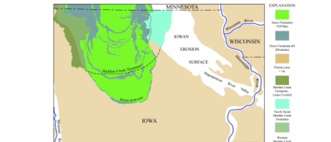
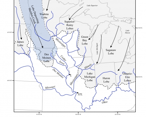
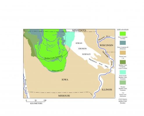
Researchers have long recognized that a pre-Des Moines Lobe glacial advance was present in Iowa and initially referred to this as the Tazewell till. Later work in the 1990s renamed this advance the Sheldon Creek Formation; however, the distribution and timing were still in question because of the limited number of accessible exposures and age dates. Recent data suggest that two advances of the Sheldon Creek were present in Iowa, one between 46,000–40,000 years ago and another from 34,000–29,000 years ago.
Sponsor: U.S. Geological Survey’s STATEMAP program
Background: Surficial geologic mapping in Worth, Cerro Gordo, Mitchell, and Floyd counties as part of the USGS STATEMAP program has extended the Sheldon Creek glacial advance margin much farther east than was previously mapped.
Team: IGS Geologists Stephanie Tassier-Surine and Phil Kerr
Date: 2010s
IGS Strategies: Correlation using traditional lithologic and chemical characteristics is problematic because of the extensive erosion associated with the formation of the Iowan Erosion Surface and the presence of shallow bedrock throughout much of the area. Refining the timing and distribution of this glacial advance has significant implications for regional and global studies of climatic and environmental change throughout the Wisconsin Episode.
Locations and Methods
- Counties mapped include Worth, Cerro Gordo, Mitchell, and Floyd
- Mapping has included both quadrangle (1:24,000) and county (1:100,000) scales
Additional Information / Publications
Kerr, P., Tassier-Surine, S., Streeter, M., Liu, H., and Clark, R., 2018, Surficial Geologic Map of Floyd County, Iowa: Iowa Geological Survey, Open File Map OFM-18-2, 1:100,000 scale map sheet.
Quade, D., Tassier-Surine, S., Liu, H., McKay, R.M., and Giglierano, J.D., 2012, Surficial Geology of Worth County, Iowa: Iowa Geological and Water Survey, Open File Map OFM-12-2, 1:100,000 scale map sheet.
Tassier-Surine, S., Quade, D., Kerr, P., Streeter, M., Liu, H., Clark, R., Fields, C., McKay, R., and Rowden, R., 2015, Surficial Geology of Cerro Gordo County, Iowa: Iowa Geological Survey, Open File Map OFM-15-2, 1:100,000 scale map sheet.
Tassier-Surine, S., Kerr, P., Clark R., Streeter, M., and Liu, H., 2016, Surficial Geology of Mitchell County, Iowa: Iowa Geological Survey, Open File Map OFM-16-2, 1:100,000 scale map sheet.