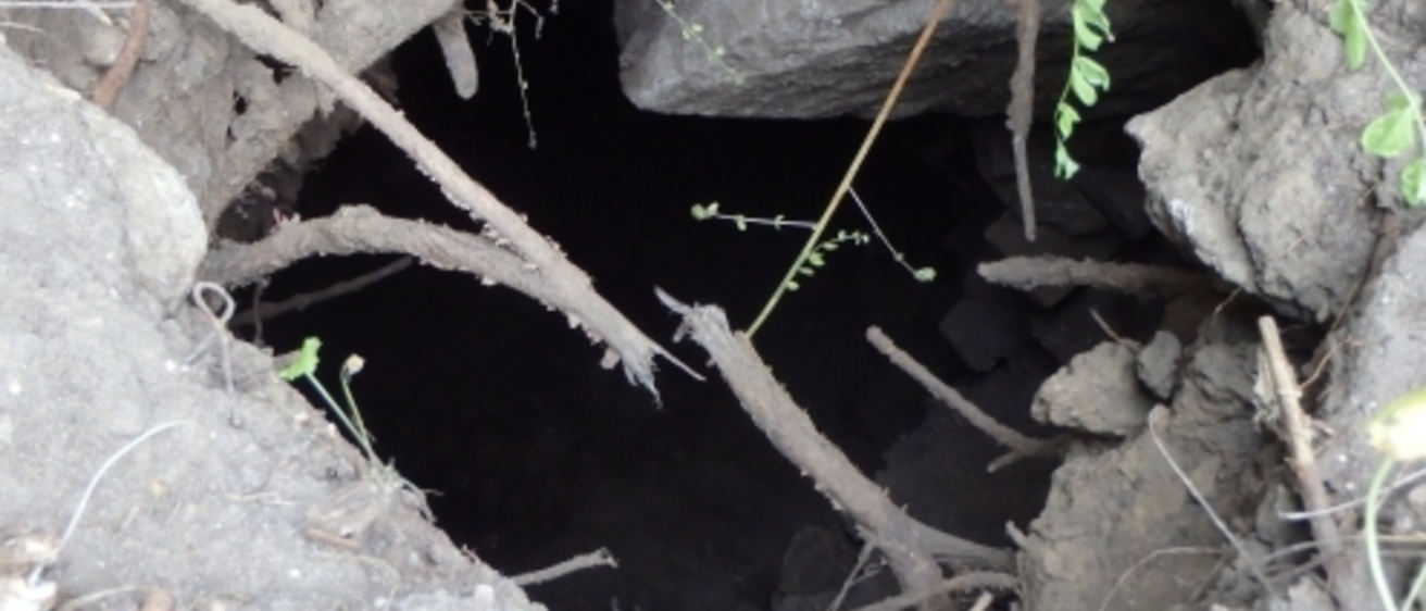
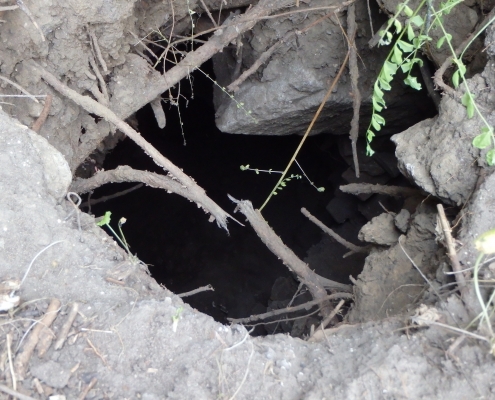
In the summer of 2014, heavy rains opened a sinkhole near the Seventh Street off-ramp in downtown Cedar Rapids.
Iowa Department of Transportation (IDOT) bridge inspectors noted that that the sinkhole seemed to open into some sort of underground cavern. After consultation with the Office of the State Archaeologist, it was determined that the sinkhole offered entry to one of the city’s long-abandoned beer caves. The IGS was contracted to use advanced geophysical technology to help detect and delineate the structures without needing to venture below ground level.
Project Details
Sponsor: Iowa Department of Transportation
Background: IGS researchers explored sinkholes or “beer caves” near Interstate 380 in downtown Cedar Rapids. Using advanced geophysical technology, they were able to detect and delineate the structures without ever venturing below ground level.
Goal: To use geophysics technology to help identify and map the extent of the caves
Date: 2014–15
IGS Strategies: IGS geologist Jason Vogelgesang led the team conducting the study. He conducted extensive studies of the area using electrical resistivity (ER) and electromagnetic terrain conductivity (EM) methods. With this technology, they could to model the subsurface to learn more about the location and the extent of the beer caves.
A Draft of History
In the summer of 2014, heavy rains opened a sinkhole near the Seventh Street off-ramp in downtown Cedar Rapids. Iowa Department of Transportation (IDOT) bridge inspectors found the sinkhole and noted that it seemed to open into some sort of underground cavern. The inspectors lowered a camera into the void, and the resulting photos prompted further investigation.
After consultation with the Office of the State Archaeologist, it was determined that the sinkhole offered entry to one of the city’s long-abandoned beer caves.
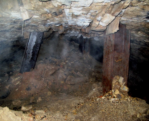
These underground barrel-vaulted masonry “caves” for beer storage are now more than a century old, but they are structurally sound. Skilled artisans working for Cedar Rapids breweries, many of them European immigrants, constructed the caves in the tradition of similar French and German beer caves. After the breweries closed, authorities partially filled in at least some of the caves in an effort to stop vandals, daredevils, and the homeless from occupying the caves.
Outcomes
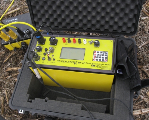
IGS used electrical resistivity (ER) and electromagnetic terrain conductivity (EM) to collect geophysical data to evaluate subsurface conditions and determine the presence and orientation of subsurface caverns.
They modeled the subsurface to learn more about the location and the extent of perhaps three beer caves in the immediate area.
Additional Information/Publications
“Cedar Rapids beer caves to get further study,” Cedar Rapids Gazette, Nov. 14, 2014.
Contact Us

Jason Vogelgesang
Hydrogeologist
Geophysics, Geological Data Preservation
MS, University of Iowa
104 OIGS
319-335-4231
jason-vogelgesang@uiowa.edu